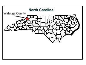
Named for the Watauga River, Watauga (wah-TAW-guh) County North Carolina was formed in 1849 from Ashe, Wilkes, Caldwell and Yancey counties. Located in the NW section of the state, it is bounded by the state of Tennessee, and by Ashe, Wilkes, Caldwell and Avery Counties. Area: 320 square miles. County seat: Boone; elevation 3,226 ft. Townships: Bald Mountain, Beaverdam, Blowing Rock, Blue Ridge, Boone, Brushy Fork, Cove Creek, Elk, Laurel Creek, Meat Camp, New River, North Fork, Shawneehaw, Stoney Fork, and Watauga.
(Powell, William S. The North Carolina Gazetteer : A Dictionary of Tar Heel Places. Chapel Hill: The University of North Carolina Press, 1968.)